Before you start your visit of Barcelona by bike, just take a minute to look at the map of Barcelona: the street pattern tells you a lot about the history of the city.
When you decide to first visit Parc Güell, you will go meandering through the labyrinth of narrow streets and lively squares of early 19th century Gràcia, now a neighbourhood of Barcelona with its own, very special character and traditions. Other similar neighbourhoods, each with its own character, are Sant Andreu and Sants.
 |
| A street in Gràcia |
The layout of these neighbourhoods contrasts sharply with the uniform, geometrical layout of late 19th, early 20th Century Eixample, where the main modernista monuments, including Sagrada Familia and Casa Milà, are situated.
The explanation of this map layout of Barcelona is to be found in the outcome of the Spanish Succession War (1700-1714): the Catalans were defeated, Catalunya lost its historic privileges and Barcelona was punished, to the effect that it was not allowed to expand within a mile beyond its medieval city walls.
Therefore, when, during the Industrial Revolution, big production plants were needed for the textile industry, these had to be built a mile away from the old city. Gràcia, Sants and Sant Andreu were villages that grew according to no specific urbanistic plan, in accordance with the need of work force and craftsmen, hence their chaotic street pattern.
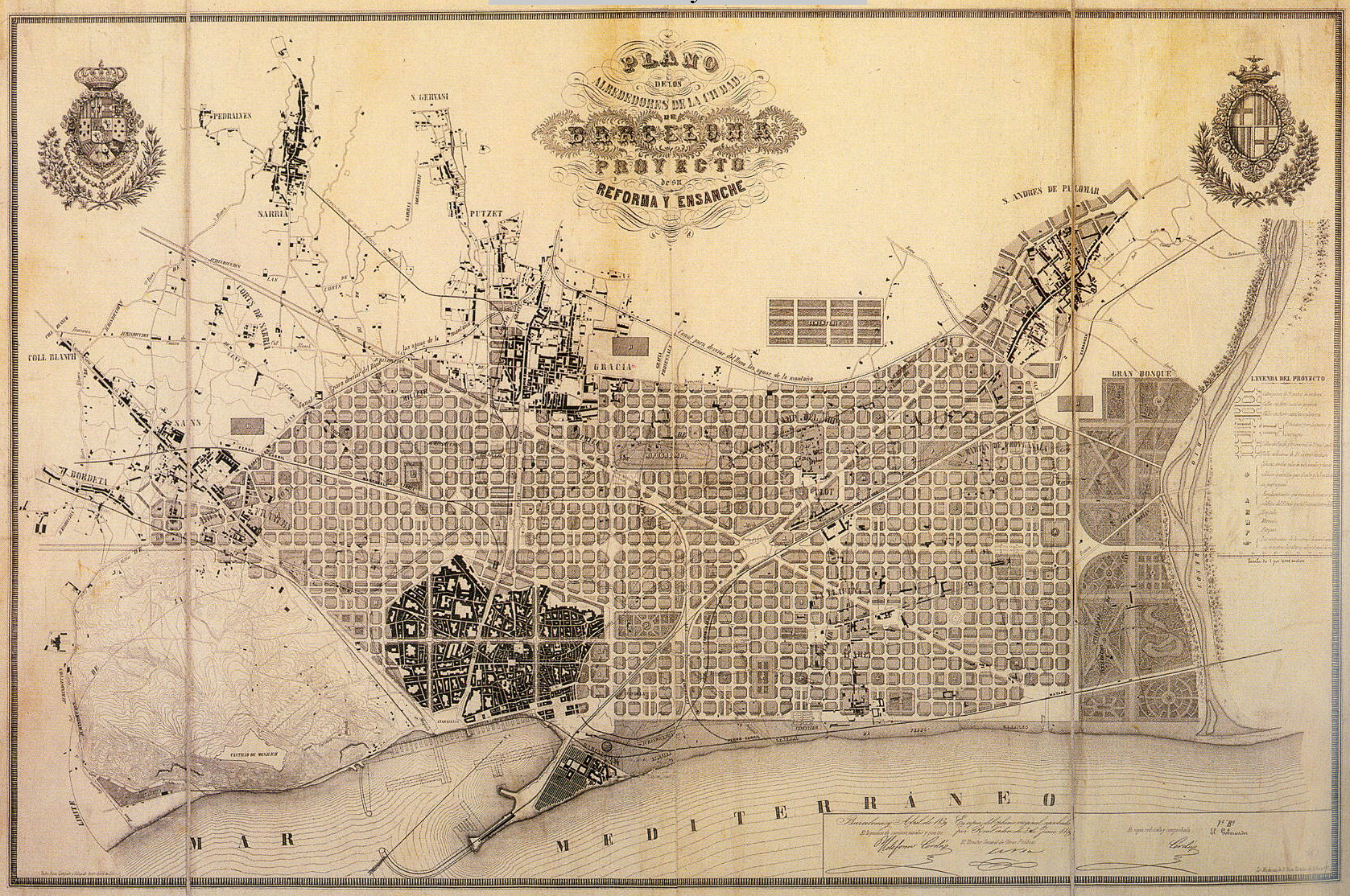 |
| Plan Cerdà from Ildefonso Cerdà, 1859 |
But when mid 19th Century Barcelona was finally allowed to tear down its city walls and to build up the lands beyond, this was done according to a general Plan, designed by Ildefonso Cerdà, the so-called Plan Cerdà. This Plan conceived the new Barcelona as a geometrical grid of wide, comfortable streets where the wealthy built their houses and palaces.
 |
| Actual picture of el Eixample |
No hay comentarios:
Publicar un comentario